Damaraland
Damaraland
Semi-arid region in northwestern Namibia, Damaraland is home to UNESCO rock engravings, the country's highest peak, and wildlife adapted to desert conditions.
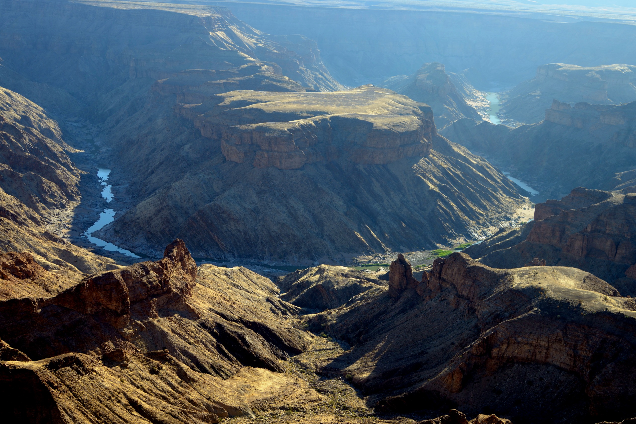
Damaraland spans 47,990 km² in northwestern Namibia, bordered to the east by the Skeleton Coast and to the west by the Kalahari Desert. This semi-arid region combines granite massifs, gravel plains, ephemeral rivers, and rock art sites among the oldest in southern Africa. Khorixas, the main settlement, serves as a base for exploring Twyfelfontein, Brandberg, and the petrified forest.
Why visit Damaraland
- A UNESCO-listed site, Twyfelfontein, featuring rock engravings dating back 2,500 to 6,000 years.
- The country's highest peak, Königstein (2,573 m), at the heart of the Brandberg massif.
- Desert-adapted wildlife: desert elephants, black rhinos, oryx, giraffes, kudus.
- Remarkable endemic flora, including Welwitschia mirabilis, which can live up to 2,500 years.
- Unique geological landscapes: petrified forest, basalt organ pipes, Spitzkoppe's granite dome.
History and settlement
The region takes its name from the Damara people, one of the earliest established groups in this part of southern Africa. The Bushmen (San), the Khoi, and later the Herero also occupied these lands for centuries, leaving behind rock engravings and oral traditions.
Under South African apartheid rule, Damaraland was established as a bantustan—a separate territory designated for a specific indigenous population. With Namibia's independence in 1990 and the gradual abolition of the system between 1990 and 1994, the region was reintegrated into the national whole and opened to tourism.
What to see in Damaraland
The Brandberg massif
A massif of volcanic origin, Brandberg peaks at Königstein at 2,573 m, Namibia's highest mountain. Its nickname "mountains of fire" comes from the red and orange hues the rock takes on at sunrise and sunset. A walk of about two hours leads to Tsisab Gorge and Maak shelter, which concentrates engravings about 6,000 years old. The most famous, called the "White Lady," continues to spark divergent interpretations: a hunting scene, shamanic ritual, or healer figure.
Twyfelfontein
Inscribed as a UNESCO World Heritage Site in 2007, Twyfelfontein holds one of Africa's largest collections of rock engravings, dated to 2,500 to 6,000 years ago and attributed to the San and Khoi. The motifs depict animals (giraffes, rhinos, lions, elephants, ostriches, as well as seals—evidence of trade with the Atlantic coast), geometric forms, and hybrid figures evoking shamanic practices.
The petrified forest
About forty kilometers west of Khorixas, the petrified forest brings together roughly fifty fossilized trunks over 200 million years old. The longest measures approximately 40 m with a diameter of 6 m. These trees are thought to have been swept from central Africa by ancient floods, then buried under sediments and mineralized. A few Welwitschia mirabilis plants grow around the sandstone rocks.
Burnt Mountain and Organ Pipes
Near Twyfelfontein, these two sites bear witness to the region's volcanic past. Burnt Mountain owes its blackened base to lava flows that calcined the underlying limestone. Just next to it, the Organ Pipes form vertical basalt columns, reaching about 4 m in height, resulting from the cooling and erosion of ancient volcanic intrusions.
Spitzkoppe
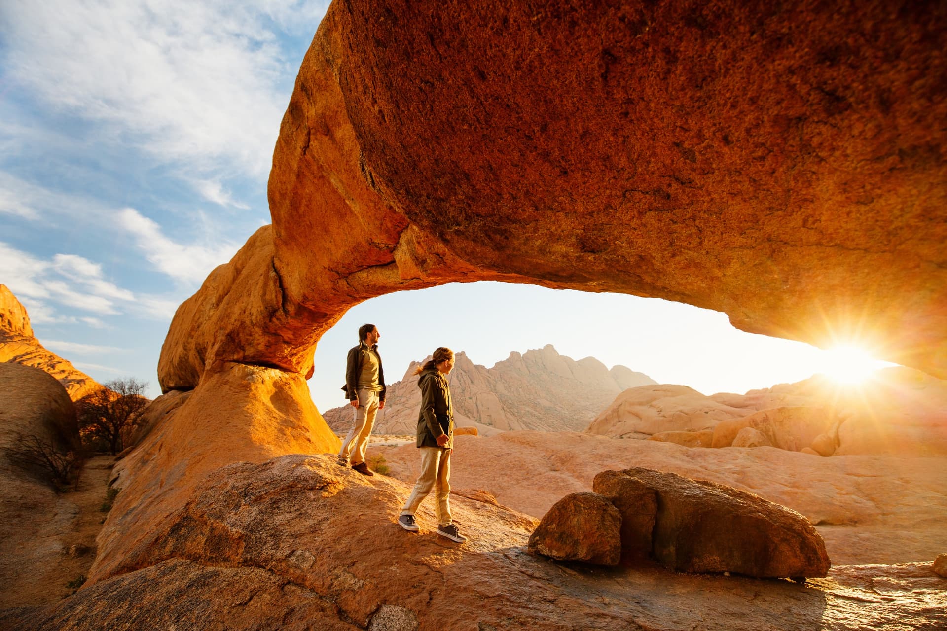
At the western edge of Damaraland, Spitzkoppe is a granite massif roughly 700 million years old, its pointed silhouette rising from a flat plain. It features natural basins filled by rainfall, a rock arch, and discreet wildlife including the rock dassie, a small mammal endemic to the region.
Fauna and flora
Palmwag reserve and the ephemeral river valleys of Hoarusib and Hoanib offer the best chances to observe desert elephants, black rhinos, gemsboks, springboks, kudus, giraffes, zebras, and baboons. On the vegetation side, several species are endemic: Welwitschia mirabilis, Brandberg acacia, Hyphaene petersiana palm, Namibian myrrh, and Euphorbia damarana, toxic to most animals except black rhinos and oryx.
Practical information
- Recommended duration: 3 to 5 days to combine Twyfelfontein, Brandberg, and a reserve like Palmwag.
- Accommodation: lodges and tent camps, often remote; advance booking recommended in high season.
- Equipment: hiking boots, ample water, sun protection, warm clothing for winter evenings.
- Guidance: a local guide is required to access rock art sites and strongly recommended for wildlife viewing.
When to visit
The dry season, from June to September, remains the most favorable period. Daytime temperatures are manageable, rainfall absent, and wildlife concentrates around rare water sources, facilitating observation. Winter nights can be cold, sometimes near freezing. The hot season, from November to March, brings intense heat and sporadic showers.
How to get there
Hosea Kutako International Airport, near Windhoek, is the country's main gateway, with regular flights from Europe via Frankfurt or Johannesburg. From Windhoek, Damaraland is reached in 5 to 7 hours by road depending on your final destination (Khorixas, Twyfelfontein, or Palmwag). A rental car, ideally a 4x4, remains the most flexible option. A few domestic flights serve airstrips at the lodges.
Nearby
Damaraland fits naturally into a broader itinerary. To the west, the Cape Cross seal colony heralds the Skeleton Coast. The Brandberg massif deserves a visit in its own right. Further northeast, Etosha National Park complements wildlife viewing. To the south, Sesriem Canyon and the Sossusvlei dunes extend your exploration of wide-open spaces.
Frequently asked questions
Allow at least 3 days to see Twyfelfontein, Brandberg, and a natural site like the petrified forest. A week allows you to add Palmwag, Spitzkoppe, and hiking.
A 4x4 is strongly recommended. The tracks are gravel or sand, sometimes rutted, and certain areas around Palmwag or the ephemeral rivers are accessible only with a high-clearance vehicle.
Sightings are never guaranteed: these elephants roam vast territories. The Palmwag, Hoarusib, and Hoanib zones offer the best odds, ideally with a local guide.
No. Access to the engravings is only with an official site guide, on marked trails, to protect the rock art.
The dry months of May to September offer crisp light and sharp contrasts, especially at the start and end of the day over Brandberg and Spitzkoppe.
Preparing your trip
To integrate Damaraland into a broader itinerary combining the Namib Desert, Atlantic coast, and Etosha National Park, consult our custom-made Namibia trips.
Interested in this visit?
We can include it in your personalised itinerary.