The Orange River
The Orange River
Natural frontier between Namibia and South Africa, the Orange River can be explored by canoe and kayak through the desert landscapes of the Richtersveld.
The Orange River marks nearly 800 km of the natural border between Namibia and South Africa, from its source in the Drakensberg Mountains in Lesotho to its mouth in the Atlantic Ocean. At approximately 2,160 km long, it is the longest watercourse in South Africa and one of the main waterways of southern Africa. On the Namibian side, it is generally accessed from the Noordoewer border post, opposite the South African town of Vioolsdrif, the starting point for most canoe and kayak excursions.
Why visit the Orange River from Namibia
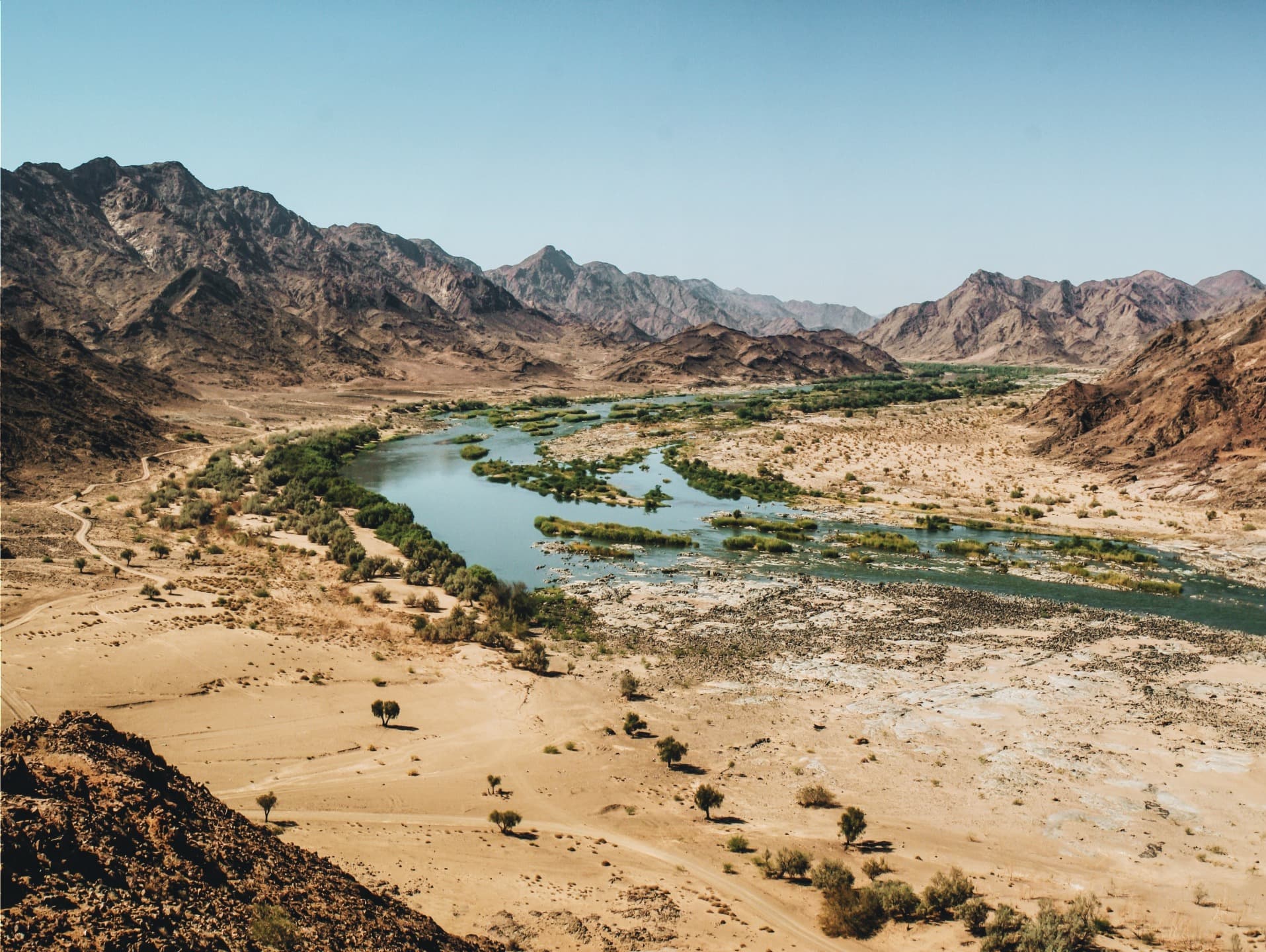
The Orange River offers a striking contrast to the rest of Namibian landscapes: a ribbon of green water cutting through the aridity of the country's south, between rocky cliffs and the Richtersveld Mountains. It is one of the few places in Namibia where multi-day water activities are practiced in a sparsely populated desert setting. The area naturally fits into an itinerary combining Fish River Canyon, Ai-Ais, and southern Namibia's grandest attractions.
History and nomenclature
Before the colonial period, the river was known as the Gariep. It was renamed Orange in 1779 by Jacob Gordon, commander of the Dutch East India Company garrison at the Cape, during an expedition into the interior. Its principal tributary, the Vaal, means "grey" in Afrikaans, in contrast to the more orange-hued waters of the main river. Following the end of apartheid, South African official communications reintroduced the name Gariep, while Orange remains the international designation.
The river also shaped the region's economic history: in 1867, the Eureka diamond was discovered near Hopetown in the river's bed. Two years later, the discovery of the Star of South Africa triggered the diamond rush that would permanently transform southern Africa.
What to see and do
Canoe, kayak and rafting
The most frequently visited section for paddling is located on the lower course, between Noordoewer/Vioolsdrif and the crossing of the Richtersveld. Excursions span two to six days depending on the package, with bivouacs on sandy beaches beside the water. Daily progress typically ranges from 20 to 30 km depending on the water flow. Rapids remain moderate throughout most of the journey, making the activity accessible to beginners with qualified guides.
Richtersveld landscapes
The section bordering the |Ai-|Ais/Richtersveld transboundary park crosses one of the sub-region's most spectacular mountain deserts. Ochre cliffs, alluvial terraces, and endemic succulent vegetation (welwitschia, halfmens, euphorbias) compose a mineral landscape very different from the Namib dunes.
Fish fauna and wildlife watching
The river is home to several fish species, including Mozambique tilapia, common carp, and gambusia; towards Lesotho, rainbow trout, an exotic introduced species, can also be found. The banks welcome a rich bird population, notably kingfishers, herons, and bee-eaters.
Extensions in South Africa and Lesotho
Beyond the Richtersveld, the river's basin flows through remarkable protected areas: the Gariep Dam Nature Reserve and Doornkloof Park shelter Cape elands, greater kudus, and cape foxes; Mokala National Park is home to Cape buffalo, warthogs, zebras, giraffes, and several antelope species. In Lesotho, the Semonkong region is known for its Basotho ponies and the Maletsunyane Falls, among the highest in Africa.
Technical landmarks
- Gariep and Vanderkloof dams, which irrigate the arid plains downstream.
- Vanderkloof hydroelectric station, the country's first power plant to generate electricity entirely underground.
- Upington: the only major city crossed by the river downstream.
When to go
The typical season for rafting and canoeing generally extends from March-April through September, following the opening of dam spillways upstream and the end of summer rains. Water flow is then sufficient for comfortable paddling, and daytime temperatures remain manageable. The southern hemisphere winter months (June-August) offer clear skies but cool nights at camp. Best to avoid the height of summer (December-February), which is very hot and subject to unpredictable flooding.
Practical information
- Required level: no prior experience necessary for guided descents; general good fitness is recommended.
- Excursion duration: from half a day to six days, with 4 days being the most common option.
- Equipment: quick-drying clothing, closed shoes for water, hat, high-protection sunscreen, waterproof bag for personal items. Paddle equipment and camping gear are provided by operators.
- Formalities: passport required, as the river is an international border.
- Budget: moderate to mid-range pricing depending on duration and comfort level chosen.
How to get there
From Windhoek, allow a full day of driving (approximately 800 km) due south via the B1 to Grünau, then Noordoewer at the border. From Fish River Canyon or Ai-Ais, the connection to Noordoewer takes two to three hours. Most operators arrange client pickup directly at Noordoewer or Vioolsdrif on the South African side of the bridge. A standard tourist vehicle is sufficient to reach the departure point.
Combine with
A paddling trip on the Orange fits well into a southern Namibia circuit. Before or after the activity, you can extend to Damaraland and its volcanic landscapes, the Brandberg massif for its rock art, or the coast around Cape Cross and its seal colony. Further north, Mahango Game Reserve and Chobe National Park complete a varied itinerary for wildlife viewing.
Frequently asked questions
Frequently asked questions
Preparing your trip
The Orange River is one of the possible stops on a circuit through greater southern Namibia, to be combined with canyons, deserts, and game parks across the country. To build a tailor-made itinerary incorporating this paddling experience, explore our Namibia travel suggestions.
Interested in this visit?
We can include it in your personalised itinerary.