Fish River Canyon
Fish River Canyon
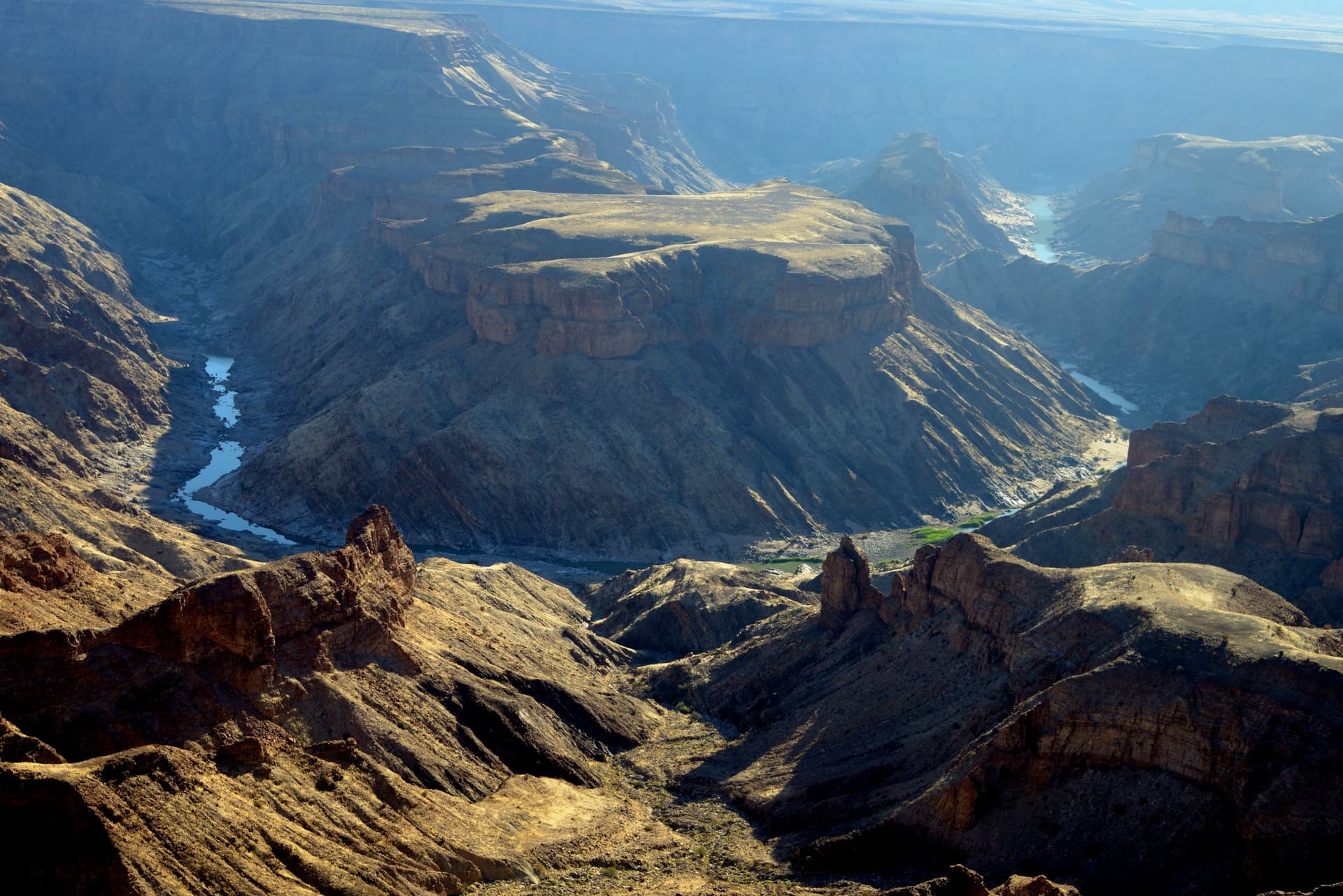
In southern Namibia, Fish River Canyon stretches 160 km of gorges plunging 550 m deep—the world's second-largest canyon after Colorado's Grand Canyon.
In southern Namibia, the Fish River Canyon cuts through an arid plateau for nearly 160 km long and 27 km wide, reaching depths of around 550 m. It ranks as Africa's largest canyon and the world's second-largest after the Grand Canyon in Colorado. The site takes its name from the Fish River, an 800 km waterway that originates east of the Naukluft Mountains and joins the Orange River at the Ais Ais hot springs.
Why visit Fish River Canyon
The canyon offers remarkable geological terrain, with panoramic viewpoints overlooking gorges carved through layers of sandstone, lava, and schist. Its relatively light visitor traffic, owing to its remote location, allows for a more contemplative experience than other southern Namibian sites. Hiking enthusiasts will find one of southern Africa's most challenging trails here: the Fish River Hiking Trail. Self-drive travelers, meanwhile, can enjoy viewpoints accessible by vehicle from Hobas.
Geological history
The landscape formed roughly 2 billion years ago from layers of sandstone, lava, and schist compressed by tectonic activity and heat. The valley then carved itself deeply around 500 million years ago through the combined action of tectonic movements and river erosion. This origin distinguishes Fish River Canyon from Colorado's Grand Canyon, whose formation stems primarily from climatic factors.
The river's flow is now intermittent, peaking in late southern summer. During the dry season, the river shrinks to a series of isolated pools where wildlife gathers to drink.
What to see and do
The Hobas viewpoints
Hobas, located roughly 70 km from Ais Ais in the Ais-Ais Richtersveld transboundary park, groups the main viewpoints. A walk along the canyon's edge strings together several panoramas of the canyon's meanders. Part of the landscape visible from these vantage points belongs to private properties.
The Fish River Hiking Trail
The trail connects Hobas to Ais Ais over 85 km, achievable in 3 to 5 days of hiking within the canyon. The initial descent of around 500 m takes 1 to 2 hours, then follows the river bed across stony or sandy stretches. No facilities exist along the route: you must be entirely self-sufficient in water, food, sleeping gear, and first aid supplies.
Canyon descent is only permitted as part of this guided hike. Unauthorized descent incurs fines. A medical certificate is required, and reservations must be made weeks in advance with park authorities.
Fauna and flora
The canyon sits at the junction of two biomes, Nama Karoo and Succulent Karoo, separated by a transitional ecotone. Succulent Karoo is recognized as a biodiversity hotspot, hosting succulent plants, bulbous species, and vegetation adapted to extreme heat. The quiver tree, Namibia's national tree, thrives here alongside aloes, euphorbias, and acacias.
Wildlife includes wild horses, kudus, leopards, baboons, Hartmann's zebras, klipspringers, and steenboks. Birdlife encompasses black eagles, kingfishers, pelicans, ostriches, African fish eagles, and several heron species.
Best time to visit
Hiking is only permitted during the southern winter, from mid-April to mid-September, when temperatures drop to levels compatible with exertion in desert conditions. In summer, extreme heat and flood risks render the canyon floor impassable. Hobas viewpoints remain accessible year-round, though a winter visit offers more comfortable conditions, especially midday.
Practical information
- Duration: allow half a day for Hobas viewpoints, 3 to 5 days for the full Hiking Trail.
- Fees: park entrance at modest cost, additional charge for the hiking permit.
- Accommodation: campsites at Hobas and Ais Ais, lodges within nearby Gondwana Canyon Park.
- Hiking equipment: complete self-sufficiency in water and food, water purification system, first aid kit, sturdy hiking boots.
- Guidance: descent only on permit, medical certificate required, advance reservation essential.
How to get there
Access is from Keetmanshoop, southern Namibia's main town, via a rural road passable in the dry season but impassable during rains. Two entry gates serve the site: Hobas to the north near the main viewpoints, and Ais Ais to the south at the hiking trail's end. A personal or rental vehicle is essential, as the canyon lacks public transportation.
What to see nearby
Southern Namibia holds other striking geological sites. Sesriem Canyon, located further north near Sossusvlei, features a narrow fissure at a vastly different scale. The Brandberg massif allows you to further explore Namibia's mineral landscapes, while Cape Cross offers coastal contrast with its seal colony.
Frequently asked questions
Frequently asked questions
Plan your trip
Fish River Canyon fits naturally into an itinerary combining southern Namibia, the Namib Desert, and northern landscapes. To craft a customized program, explore our Namibia travel suggestions.
Interested in this visit?
We can include it in your personalised itinerary.